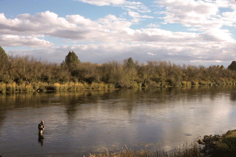
Above Island Park Reservoir
Not many would argue that the Upper Henry’s Fork from Henry’s Lake downstream to the Island Park Reservoir is not the fishery it was 40 years ago. Henry’s Lake Outlet is great during high water years when hundreds of large trout are flushed down from the lake. Otherwise, there isn’t enough water year round in the Outlet to support good numbers of large fish.
Below Big Springs the Henry’s Fork took a significant hit from the fires of 1988. The resulting sediment filled the deep pools and changed the river significantly. Years of drawdowns of the Island Park Reservoir reduced the numbers of Kokanee that migrated upstream to spawn. They were followed by large rainbows which ate their spawn and rotting carcasses. 40 years ago the river actually looked red from all of the migrating salmon.
Liberal fishing regulations have also taken a toll, especially with the few large resident trout. The IDF&G still stocks wind up hatchery trout in this section in an effort to appease the local consumptive public. This stretch is also covered up with recreational floaters from Memorial Day through Labor Day. In spite of the downside, there is still some decent fishing on this section even though it isn’t what it once was, especially in the autumn after the summer crowds are gone.
Box Canyon

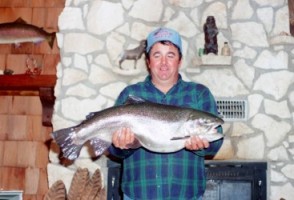
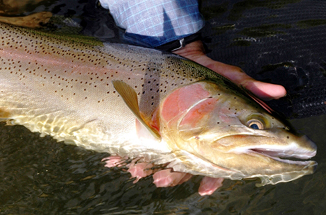
In 1976 the Box Canyon was very different than it is today. Fishing regulations allowed for the use of bait and the catch limit was 10 fish of any size. There were some colossal trout. The largest I know of was caught by Ron Dye, who, using a Rapala lure, landed a rainbow over 18 pounds. It wasn’t uncommon to hook one of those double digit titans. Those trout were undoubtedly flushed into the river from the reservoir above.
Later the fishing regulation was adapted to prohibit bait with a more restrictive limit. The current regulation still prohibits bait, single barbless hooks with catch and release. For whatever reason, after several fish eradication efforts by the IDF&G in the Island Park Reservoir, double digit rainbows are almost unheard of today. Read part one of my blog that details the effects of the Island Park Reservoir and management of the dam on the Box Canyon.
Harriman State Park
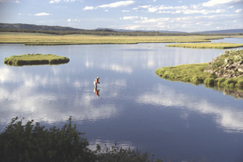
It was known as the Railroad Ranch when we opened our shop. The property was deeded to the State of Idaho in 1979 and became Idaho’s first state park in 1982. Comparing what the fishing was like then and now depends on who you talk to. One thing everybody agrees on is that this most famous river has had many challenges. While it is virtually impossible to get a solid read on the number of trout per mile, without doubt there were more trout in the 70s and 80s than today. Research has confirmed that the Ranch was artificially stocked with trout flushed from the Island Park Reservoir. Stocking windup hatchery trout was also occurring at Last Chance on an annual basis. Today some trout still move down from the reservoir but for the most part, all of the trout in the Ranch are wild. Recruitment of this wild population is totally dependent upon winter flows from the Island Park Reservoir.
The drought of the past decade has worsened. The last good water year was 2011. Without better winter flows the outlook is not good for the overall numbers of trout. It is doubtful we’ll ever see the pods of “cookie cutter” 17 inch rainbows that we saw in the old days. Yet today it is not uncommon to see rainbows up to 2 feet feeding on the surface, something you didn’t see back when.
Access has also changed. Before it became a state park the Harrimans allowed access from the log jam at Last Chance, walk in from the middle gate at the mail box, Osborne Bridge, and Green Canyon Road. Crossing this private property from any other point was not allowed. All of these access points were primitive. Over time parking, camping, litter, and human waste became serious issues. One of the first projects tackled by the Henry’s Fork Foundation was the parking area at the north access. Many of the same whiners who have spent this summer bitching and complaining about the flows on the river are the same folks who raised hell about improving this access. They could camp and park wherever they wanted and they didn’t like changes imposed upon them. After the Osborne Bridge was renovated the parking area on the highway was eliminated. A new parking area was developed below the bridge with a boat ramp. Access is also provided at the main parking area at the Millionaire’s Pool and the angler’s access at the third channel. The only access that remains relatively the same is the mailbox.
Access is also available at Harriman East below the Osborne Bridge at the gravel pit area and Wood Road 16. These areas are still primitive and haven’t changed much except the road has been improved at Wood Road 16.
Riverside to Hatchery Ford
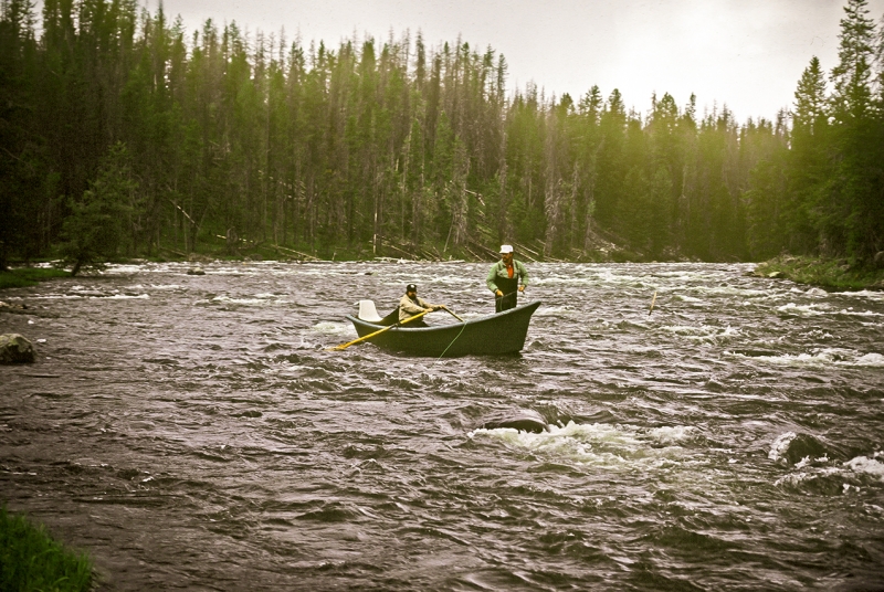
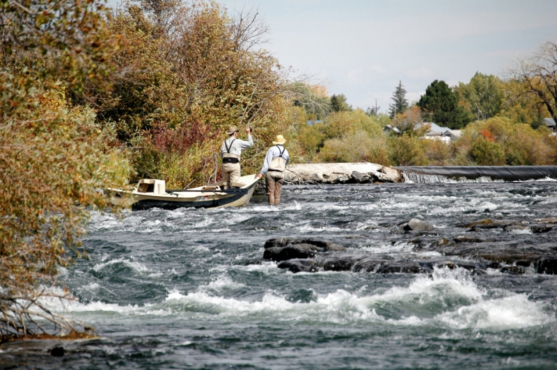
In 1982 I floated with guides Curt Barker, Tim Stamm, and A J Campbell, to check out this section of the river. None of us had floated this and we didn’t know anybody who had. We took out on the west side of the river on the old stage road which was strewn with big rocks and logs. You could only negotiate this nasty road with a jeep, Ford Bronco, or other short based 4 X 4 vehicle. The whitewater on the float was scary but not nearly as treacherous as the road at the takeout. Later we started taking out on the east side of the river at the site of the current access. That road was just as nasty. Later, after I took Senator James McClure and his wife down that section in an effort to fight proposed hydro development, he appropriated money to improve the access to what it is today. He also appropriated the money to develop the parking area at the access to the Ranch at the log jam. In my opinion the fishing hasn’t changed much in this stretch over the past 40 years. It is great in June during the salmonfly hatch but otherwise it produces mostly small fish during the course of the season. However, there isn’t a more scenic, spectacular float on the entire Henry’s Fork.
Mesa Falls

If you try to float below Hatchery Ford you die. In the unlikely event that you survive Sheep Falls you would not survive the 114 foot drop over Upper Mesa Falls. Known as Big Falls, when I was a kid, it was one of my favorite places to fish. After climbing down a steep trail, we waded across below the falls and fished the deep pools on the far side of the river. Today Mesa Falls is one of the top tourist attractions in the Yellowstone Region and rightly so. It is well worth a trip to the visitor’s center and the walk down to the falls. Today it is not legal to venture off the developed trails so you can’t go where I went as a kid.
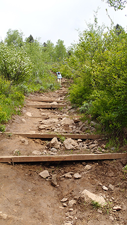
Lower Mesa Falls is a mile downstream from the upper falls. The big change here is the trail down to the water at the Grandview Campground, about ¾ river miles below the falls. In the old days we dragged our drift boats down the 2200 ft. trail to the river to float down to Warm River. In those days the trail was lightly used and hard to find. It eventually got so heavily used that it became more of a ravine than a trail. Today it has been improved substantially and only soft boats are allowed. In my opinion the fishing is actually better than it was 40 years ago. This is mostly because of brown trout which were introduced in the Henry’s Fork in the early 1980s. They get big and the love the salmonfly hatch.
Warm River to Ashton
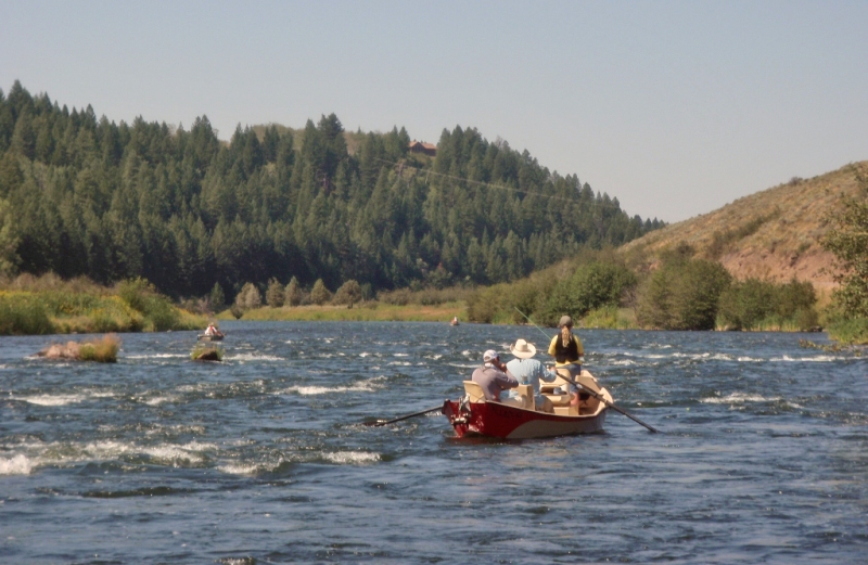
It was possible to find some good fish early in the season during the salmonfly hatch but after that, it was hard to find trout larger than 10 inches. However this float has always been the most consistent stretch of the Henry’s Fork for numbers of trout and whitefish throughout the season. I think the fishing here is much better today than 40 years ago for two reasons. 1) Brown trout were stocked in the early 1980s between the Ashton Reservoir and the headwaters of Warm River. They have thrived in this stretch of the river. 2) Fishing regulations have changed. When we first opened the shop the limit was 10 fish. Later it was reduced to 6 fish. Now the limit is 2 fish. In 80s and 90s it wasn’t uncommon to see stringers loaded with big trout caught with live sculpins. Today, even though bait is still legal, there are not nearly as many large trout harvested. Now the fishing season is open year round which provides a lot of additional opportunity, especially during the early season March Brown, caddisfly and salmonfly hatches.
Most of the land along the river is private but most landowners did not prohibit wading access. Today this has changed. There are several places where we once parked, fished and picnicked with our kids that now have No Trespassing signs. The property at the Stone Bridge boating access was also private. In order to assure this access Fremont County, with cooperation and assistance with the Henry’s Fork Foundation and other entities have purchased the land and developed a great boating access at Stone Bridge. Fremont County has also developed an access at Jump Off Canyon, a half mile upstream from the highway 20 bridge.
Ashton Dam to St. Anthony
This short tailwater stretch of the Henry’s Fork has always been productive. Mayfly, caddisfly and stonefly populations are significant. 40 years ago it produced high numbers of small trout and not many big ones. Today the reverse is true with more big trout and not as many small ones. Nobody knows exactly why. One thing for sure is that restrictive fishing regulations have favored larger trout. Like other sections of the Henry’s Fork the limit has gone from 10 trout to 6 trout to the current limit of 2 trout. I also think overall attitudes of the angling public has changed. Not many years ago fly fishing was in the minority with most anglers sporting creels. Like the stretch above, brown trout have had a significant impact on the lower Henry’s Fork. They live longer, grow larger, and are harder to fool. Before they were introduced most of the larger rainbows caught ended up in somebody’s freezer.
Fishing access has changed considerably over the past 40 years. Almost all of the land along the river is private and there were few restrictions to access the river. Roads along the river made it easy to get to the best water. Over time litter, vandalism, human waste, parking and other problems have brought about change. Fremont County has taken the lead to purchase property and develop access points at the Ora Bridge, Vernon Bridge, and the Fun Farm Bridge. There are also boating accesses above and below the Chester Dam provided by the hydro developer. The boating access at Seely’s above the Chester Backwater was eliminated due to litter and parking issues. The Landowner at the Henry’s Fork Ranch, just upstream of Seely’s currently allows wading access but the parking area is limited to no more than 3 vehicles at one time.
St. Anthony to Confluence
40 years ago there was very little interest in this stretch of the river. It was never much of a fishery. I fished here a lot as a boy. Most of the trout were native cutthroats. The river here has always suffered from low stream flows during the summer months. Like other stretches of the Lower Henry’s Fork brown trout significantly upgraded the fishery.
Access is not easy. Most of the land surrounding the river is private and difficult to get to. There is a parking area for the St. Anthony Greenway at the St. Anthony Cemetery. Boats can be launched at the head gate just upstream but boaters are required to park at the cemetery. This access is owned by a private canal company and could be lost if parking rules are not followed. There is a very primitive access below the Railroad Bridge on BLM land. Fremont County and the BLM have also provided a nice boating access at the Parker/Salem highway.
There is another access at the Idaho Department of Fish and Game access at Warm Springs. The stretch from the Parker/Salem Bridge to Warm Springs has never been much of a fishery but it is always possible to catch a monster. Next blog I’ll provide a historical perspective of the Madison, South Fork, Teton, Yellowstone Park, lakes and other surrounding waters.